
- Feed Preview OGD – Free and Open Source GIS Ramblings
Offline Vector Tile Package .vtpk in QGIS
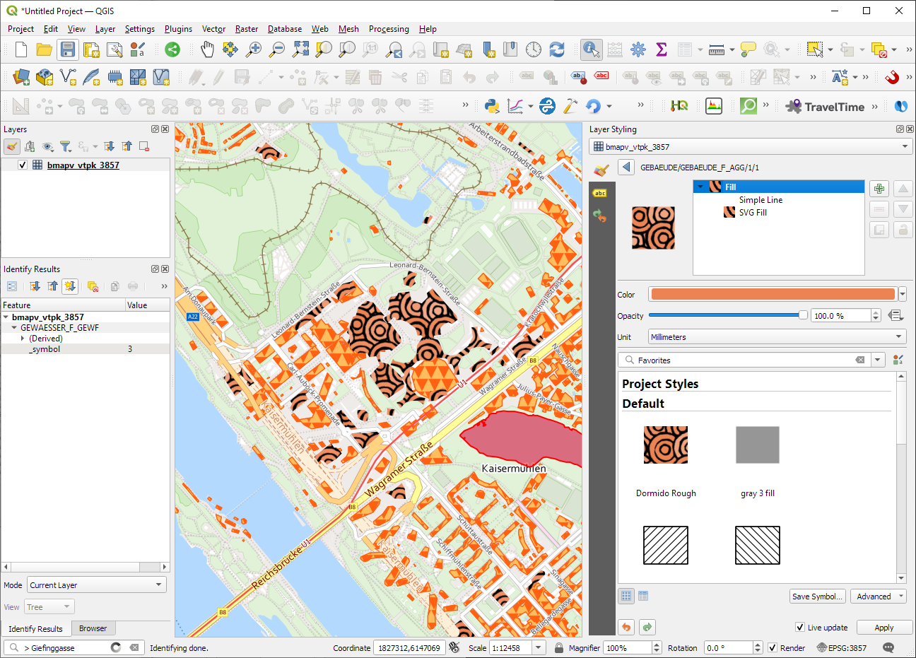
Starting from 3.26, QGIS now supports .vtpk (Vector Tile Package) files out of the box! From the changelog: ESRI vector tile packages (VTPK files) can now be opened directly as vector tile layers...
https://anitagraser.com/2023/12/15/offline-vector-tile-package-vtpk-in-qgis/
Official Austrian basemap and cadastre vector tiles
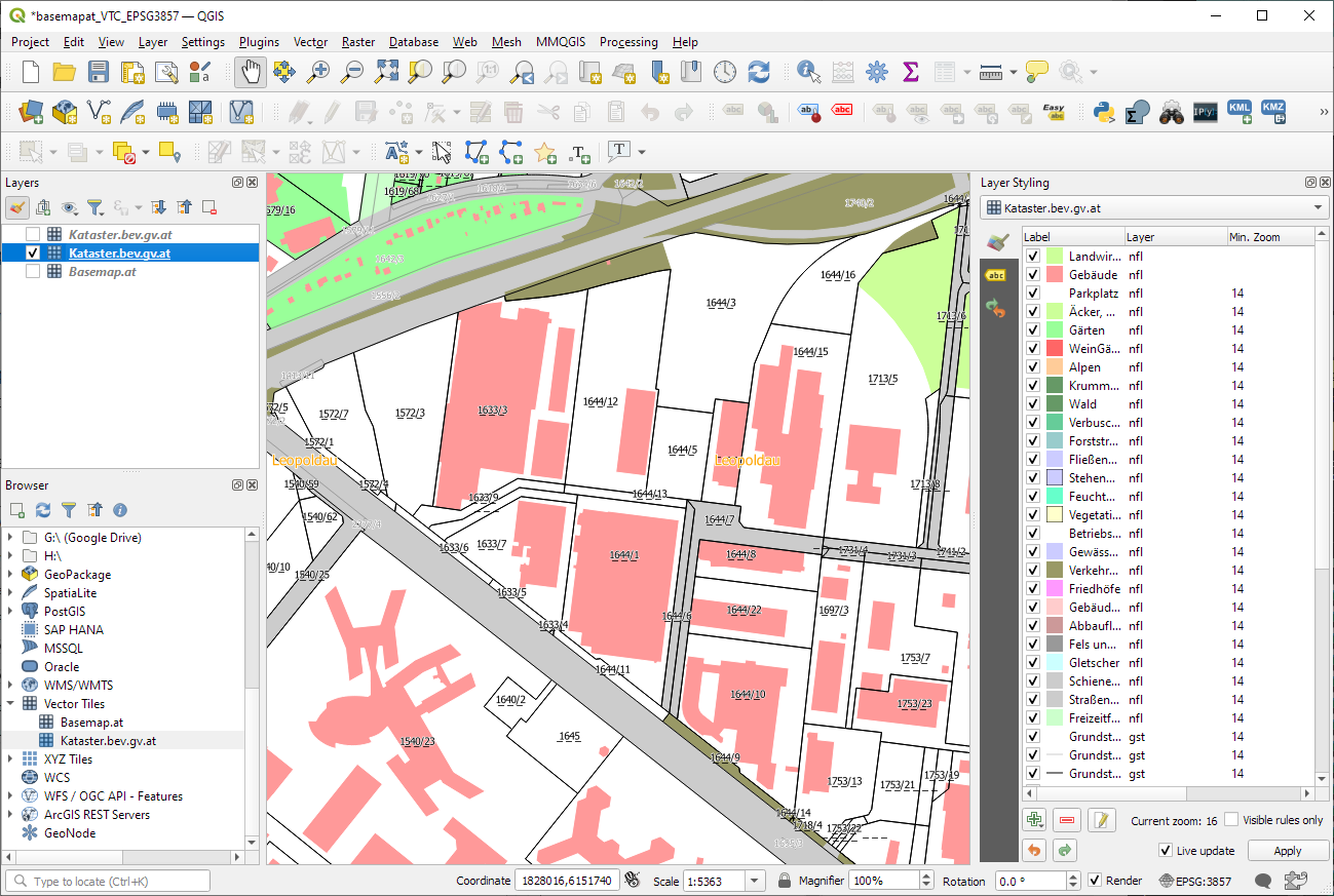
The BEV (Austrian Bundesamt für Eich- und Vermessungswesen) has recently published the Austrian cadastre as open data: The vector tile URL is: There are 4 different style variations: When confi...
https://anitagraser.com/2022/07/09/official-austrian-basemap-and-cadastre-vector-tiles/
Exploring ZAMG’s new open weather data
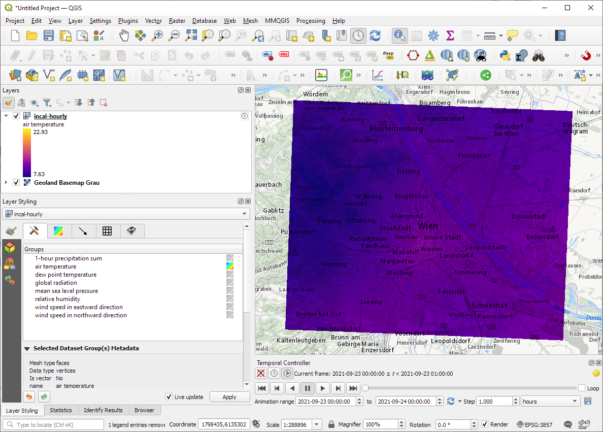
The Central Institution for Meteorology and Geodynamics (ZAMG) is Austrian’s meteorological and geophysical service. And as such, they have a large database of historical weather data which the...
https://anitagraser.com/2021/11/01/exploring-zamgs-new-open-weather-data/