
- Feed Preview QGIS – Free and Open Source GIS Ramblings
GTFS algorithms about to land in Trajectools
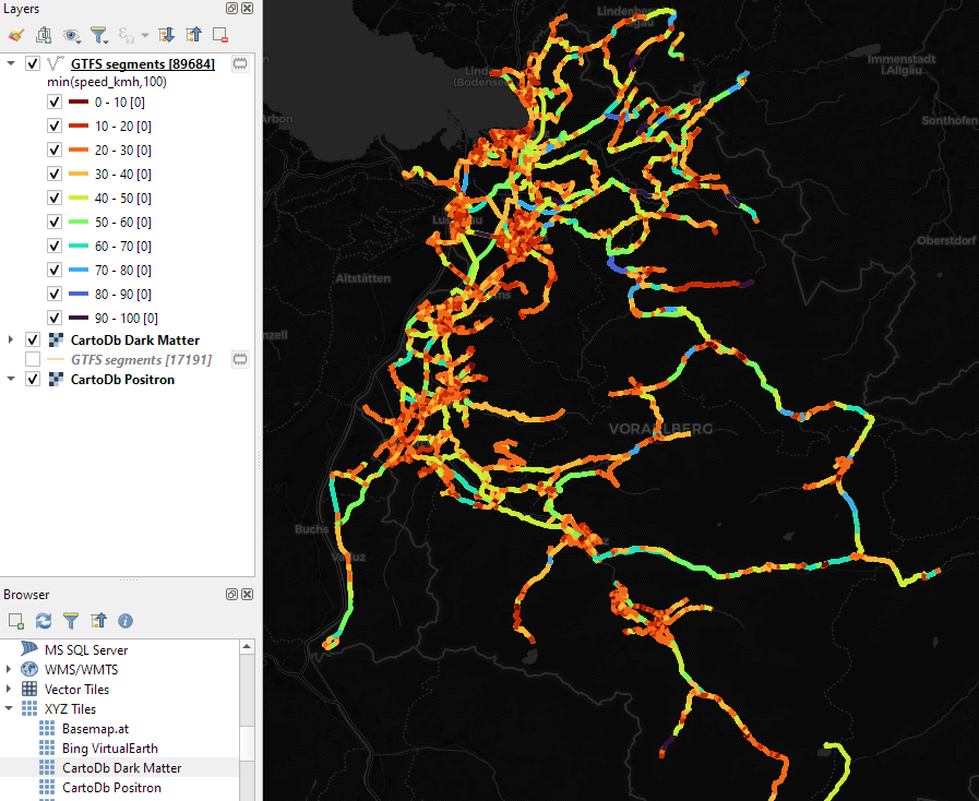
Trajectools continues growing. Lately, we have started expanding towards public transport analysis. The algorithms available through the current Trajectools development version are courtesy of th...
https://anitagraser.com/2024/05/04/gtfs-algorithms-about-to-land-in-trajectools/
Trajectools update: stop detection & trajectory styling
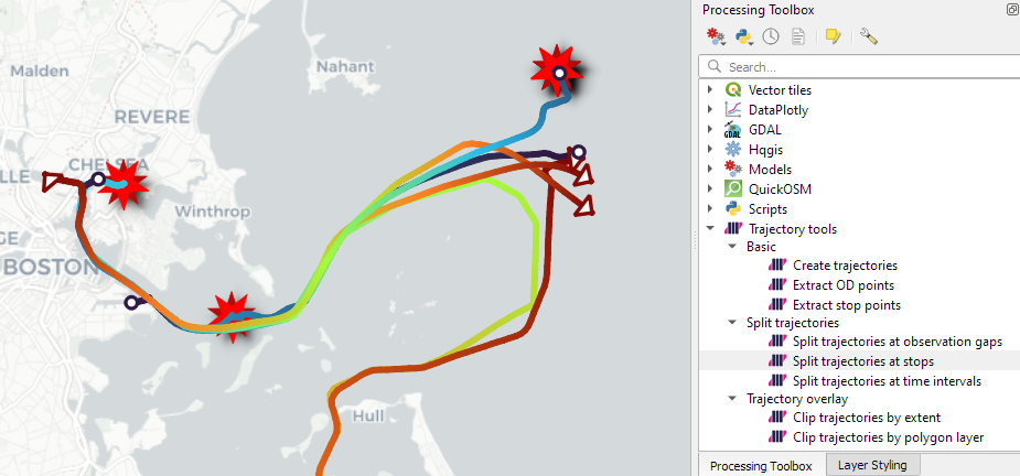
The Trajectools toolbox has continued growing: I’m continuously testing the algorithms integrated so far to see if they work as GIS users would expect and can to ensure that they can be integra...
https://anitagraser.com/2024/01/27/trajectools-update-stop-detection-trajectory-styling/
QGIS Processing Trajectools v2 in the works
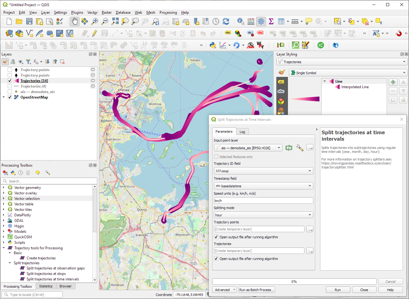
Trajectools development started back in 2018 but has been on hold since 2020 when I realized that it would be necessary to first develop a solid trajectory analysis library. With the MovingPandas...
https://anitagraser.com/2024/01/12/trajectools-v2-in-the-works/
Offline Vector Tile Package .vtpk in QGIS
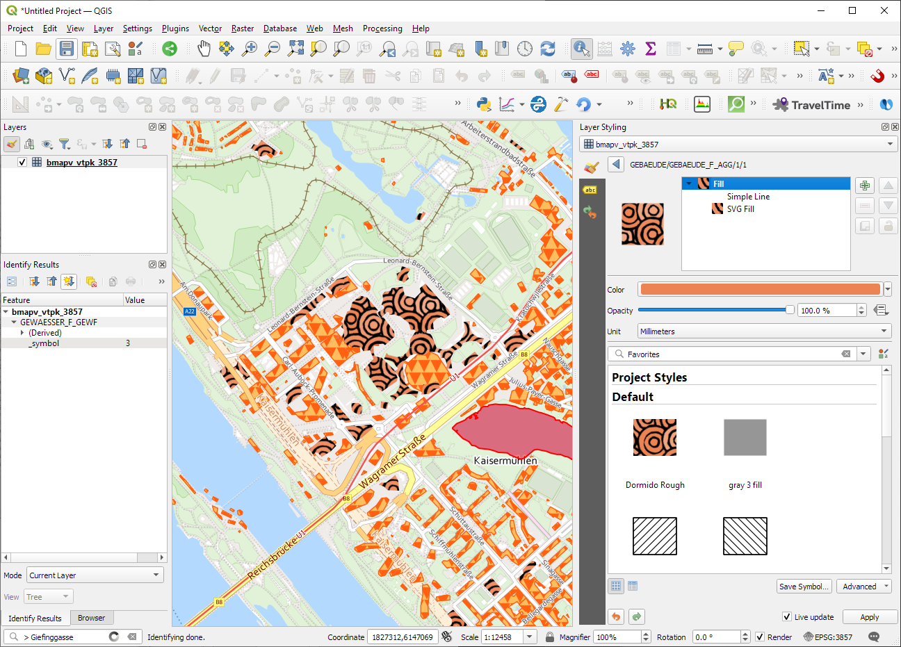
Starting from 3.26, QGIS now supports .vtpk (Vector Tile Package) files out of the box! From the changelog: ESRI vector tile packages (VTPK files) can now be opened directly as vector tile layers...
https://anitagraser.com/2023/12/15/offline-vector-tile-package-vtpk-in-qgis/
Analyzing video-based bicycle trajectories
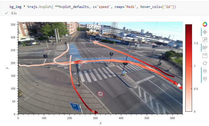
Did you know that MovingPandas also supports local image coordinates? Indeed, it does. In today’s post, we will explore how we can use this feature to analyze bicycle tracks extracted from vide...
https://anitagraser.com/2023/05/21/analyzing-video-based-bicycle-trajectories/
Tracking geoprocessing workflows with QGIS & DVC
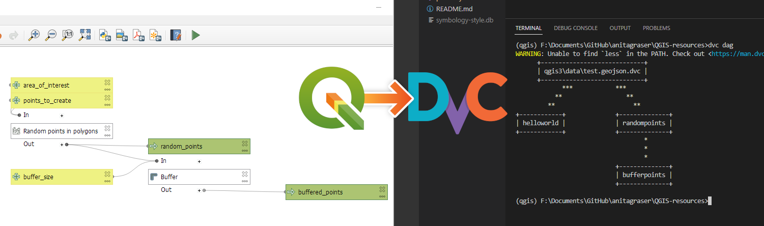
Today’s post is a geeky deep dive into how to leverage DVC (not just) data version control to track QGIS geoprocessing workflows. “Why is this great?” you may ask. DVC tracks data, paramete...
https://anitagraser.com/2023/02/25/tracking-geoprocessing-workflows-with-qgis-dvc/