
- Feed Preview ogdwien – Free and Open Source GIS Ramblings
Offline Vector Tile Package .vtpk in QGIS
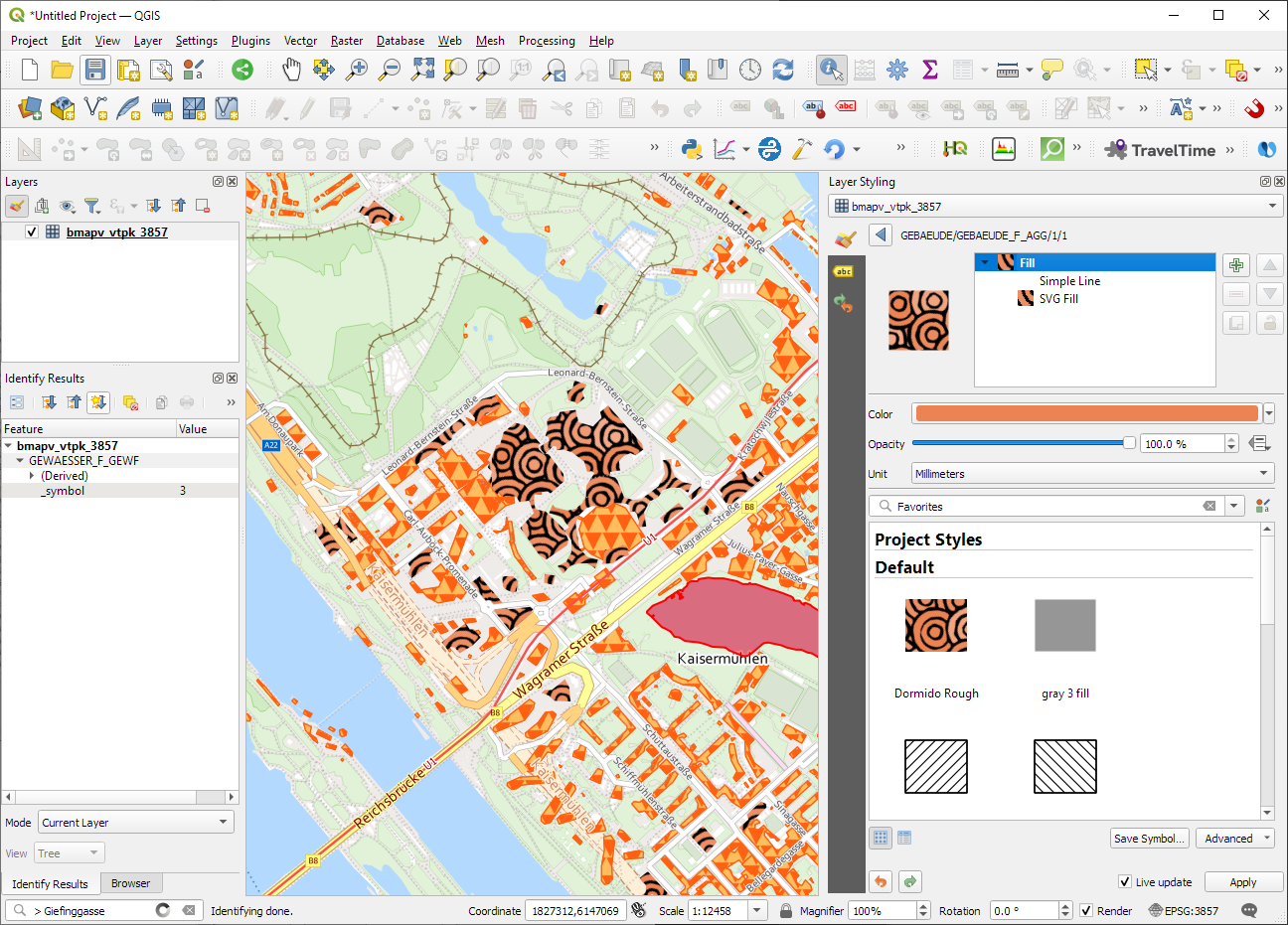
Starting from 3.26, QGIS now supports .vtpk (Vector Tile Package) files out of the box! From the changelog: ESRI vector tile packages (VTPK files) can now be opened directly as vector tile layers...
https://anitagraser.com/2023/12/15/offline-vector-tile-package-vtpk-in-qgis/
Improving Population Density Maps Using Dasymetric Mapping
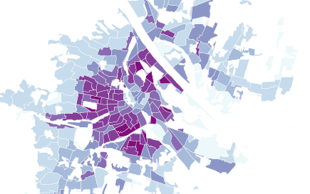
Yesterday, I described my process to generate a basic population density map from the city of Vienna’s open government data. In the end of that post, I described some ideas for further improvem...
https://anitagraser.com/2012/11/18/improving-population-density-maps-using-dasymetric-mapping/
Mapping OGDWien Population Density
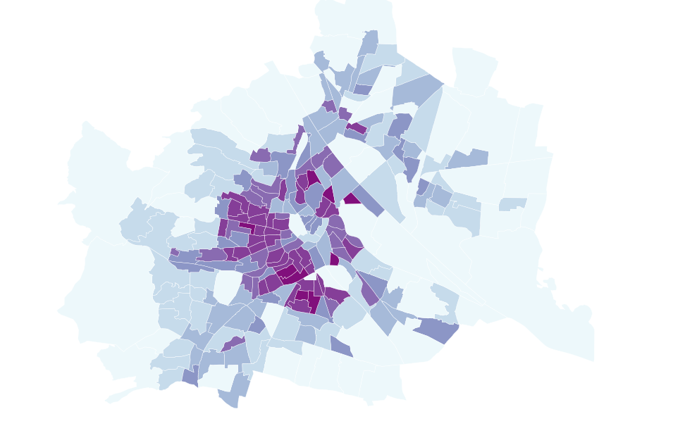
The city of Vienna provides both subdistrict geometries and population statistics. Mapping the city’s population density should be straightforward, right? Let’s see … We should be able to j...
https://anitagraser.com/2012/11/17/mapping-ogdwien-population-density/
WFS to PostGIS in 3 Steps

This is a quick note on how to download features from a WFS and import them into a PostGIS database. The first line downloads a zipped Shapefile from the WFS. The second one unzips it and the las...
https://anitagraser.com/2012/09/26/wfs-to-postgis-in-3-steps/
Mapping Density with Hexagonal Grids
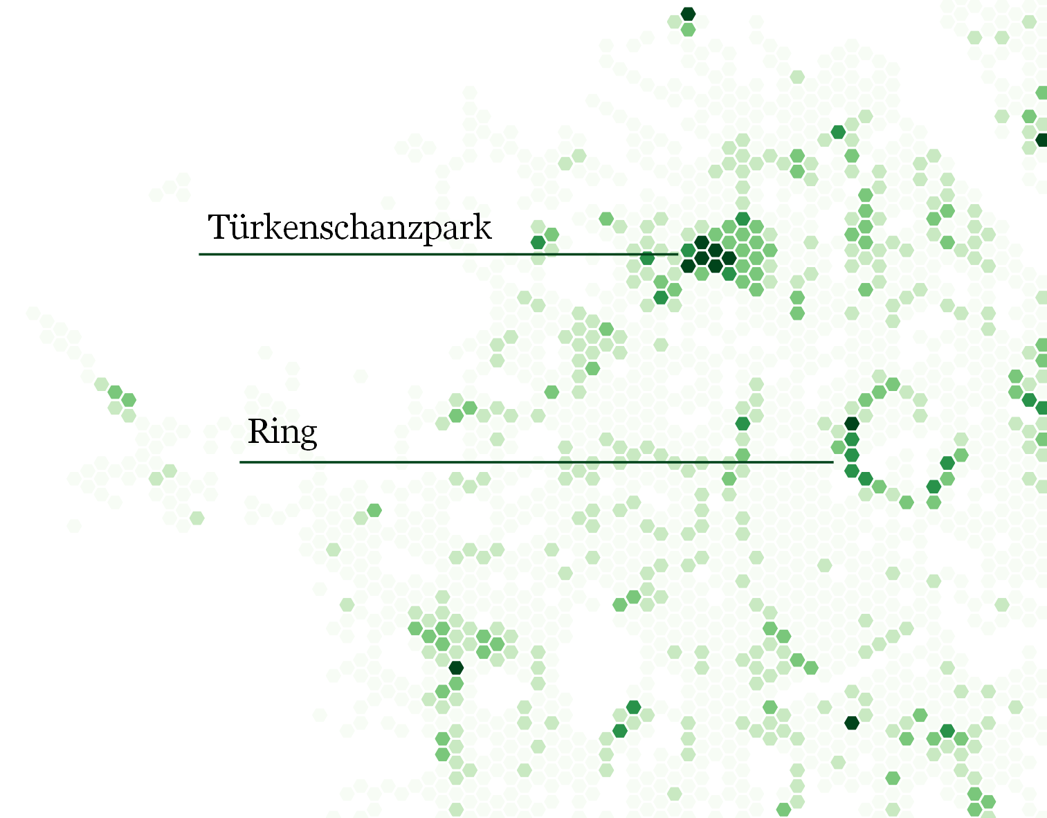
A very common approach for mapping point density is to use heat maps. If you are aiming for a different style, give hexagonal grids a try. The workflow is very simple in QGIS: Load the point laye...
https://anitagraser.com/2012/03/04/mapping-density-with-hexagonal-grids/